The Silk Road was a multi-continent trade route that spanned Asia and Europe and existed from 114 BC to 1450 AD. This vital trade route connected the Eastern and Western corners of the world.
While we have known about this route for a long time, new discoveries are changing our understanding of the Silk Road. Two archaeological sites were surveyed along the route, and they have revealed interesting new information. The aerial survays of Tashbulak and Tugunbulak (both are in the Uzbekistan mountains and are three miles away from each other), used LiDAR to uncover more than 300 medieval archaeological features. LiDAR is a remote sensing technique that uses lasers to create 3D landscape images. Both Tashbulak and Tugunbulak are 6,562 and 7,218 feet above sea-level and were discovered in 2011 and 2015. It was previously understood that because the two sites are at such high elevation, it was unlikely that there was any large-scale urban development in the area.
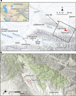
“The LiDAR results indicate that the scale of urbanization in this area was much more expansive than previously known,” Brown University researcher Zachary Silvia told Newsweek. “This is the first—and probably only—ancient or medieval city located at this elevation in Central Asia, which forces us to reconsider what we know about urbanization in the area.”
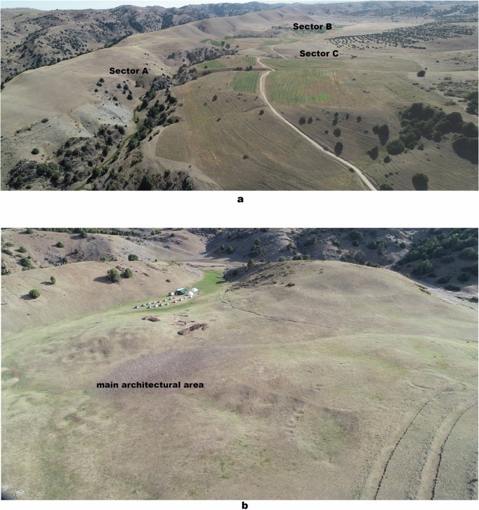
Structures that were revealed included “watchtowers connected with walls along a ridgeline, evidence of terracing, and a central fortress surrounded by walls made of stone and mud brick.”
This new discovery has also brought up more questions.
“Typically, remote sensing techniques are one tool within the broader tool kit of the archaeologist,” Silvia said to Newsweek. “The next step for the team would be to confirm their findings through geophysics—techniques that ‘see’ below the surface—and targeted excavations that can confirm whether or not this is indeed such an extensive settlement. I am optimistic that this is precisely what the team will find in the coming years.”